Most American historians and geographers are well aware of the Sanborn fire insurance maps which document the landscape of hundreds of different cities. They are tremendously useful to a wide range of scholars and researchers. What some people may not know is that the Dakin Publishing Company of San Francisco also worked to create similar insurance maps in the late 19th and early 20th centuries....
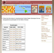
How does one map Hawaii? It's not an easy proposition, but the United States Geological Survey (USGS) has been doing just that for over a century. The University of Hawai'i at Manoa Library has created this digital archive of topographical quadrangles for the state of Hawaii, and they are a real find. Visitors to the site will note that they can view the maps by island and that each map also...
When most people envision Hawaii, they may conjure up ideas of surfing, pineapple, the island of Oahu, and other tourist-brochure inspired images. Turning some of those ideas on their head is this intriguing voyage (sponsored and documented in part by the Honolulu Advertiser) to the sometimes-neglected northwestern Hawaiian Islands on the voyaging canoe Hokule'a. On the website, visitors can learn...