In 1948, Melville J. Herskovits established the African Studies program at Northwestern University. It was the first of its kind at a major research university in the United States, and since its creation, it has also been actively involved with collecting historic maps of Africa. This particular online collection draws on this legacy of preservation and acquisition, and all told, it contains 113...
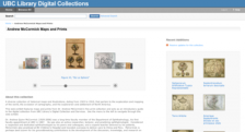
Dr. Andrew Quinn McCormick was a faculty member for many years in the department of ophthalmology at the University of British Columbia. Along with his passion for this field of medicine, he was also a great lover of maps and prints. This digital collection presents a sample of works from his collection, which he donated to the school's library. Visitors can make their way through historical maps...
The Library of Congress maintains the online map collection Web site which contains maps from 500 years in seven different categories. The site, entitled Map Collections: 1500-1999, can be browsed by cities and towns, conservation and environment, discovery and exploration, general maps, transportation and communication, military battles and campaigns, and cultural landscapes. The database can be...
Most American historians and geographers are well aware of the Sanborn fire insurance maps which document the landscape of hundreds of different cities. They are tremendously useful to a wide range of scholars and researchers. What some people may not know is that the Dakin Publishing Company of San Francisco also worked to create similar insurance maps in the late 19th and early 20th centuries....
Presented by Cartography Associates, the David Rumsey Historical Map Collection focuses on rare 18th and 19th century North and South America cartographic history materials, with an inclusion of historical maps of the World, Europe, Asia, and Africa. Some of the collection categories include old and antique atlas, globe, school geography, maritime chart, state, county, city, pocket, wall,...
The world of antique maps and atlases is a wide one, and includes such fine volumes as the exquisite atlas of New Spain created by Alexander von Humboldt in 1811 and Mitchell's School Atlas of 1847. These atlases and hundreds more can be viewed at this site, provided courtesy of the David Rumsey Historical Map Collection. Online since 2000, the antique atlas section is divided geographically into...
The Greater Philadelphia GeoHistory Network (GPGN) is a project by the Philadelphia Area Consortium of Special Collections Libraries designed "to develop a web-based repository of geographically organized historical information about Philadelphia, its geography, its buildings, and its people." It's quite an impressive endeavor, and anyone with a love for the City of Brotherly Love will want to...
Designed by librarian Matthew White, this sprawling and somewhat idiosyncratic Website offers hundreds of political, economic, demographic, religious, and historical cartographies of the countries and continents of the last century. Visitors to this site can trace the global rise and fall of various political systems through the century, examine the mapped battle histories of the Mexican...
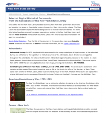
The New York State Library started digitizing a range of New York government documents in a wonderful online catalog and website. The collection covers a wide range of materials including government surveys, state census results, and first had descriptions of the Native American experience throughout the Empire State. In total, there are twelve collections here, including Laws of New York State...
This site is a recent addition to an exitsing Library of Congress (LOC) American Memory Project (last reviewed in the April 30, 1999 Scout Report) collection. The 1562 Map of America by Diego Gutierrez has been placed on the Discovery and Exploration Maps Collection page. Truly one of the LOC's greatest treasures, this handsomely engraved 1562 map of the Americas comes complete with images of sea...